Click here for PDF of the presentation
June 2012: DEMARN presented at the Israeli Association for Aquatic Sciences Annual Conference
Posted in Uncategorized
Comments Off on June 2012: DEMARN presented at the Israeli Association for Aquatic Sciences Annual Conference
First DEMARN journal article accepted for publication
Title: From the Levant to Gibraltar: A Regional Perspective for Marine Conservation in the Mediterranean Sea
Journal: Ambio — A Journal of the Human Enviornment
Date of acceptance: May, 2012
Posted in Uncategorized
Comments Off on First DEMARN journal article accepted for publication
DEMARN work presented at Mediterranean Sea Conservation workshop
 The workshop was held in Santorini, Greece, April 2-5, 2012. The workshop brought together marine conservation experts from all over the Mediterranean and the world (including the US and Australia) to look at overlaps and gaps in research and to forge a way forward. Link to workshop website
Posted in Uncategorized
Comments Off on DEMARN work presented at Mediterranean Sea Conservation workshop
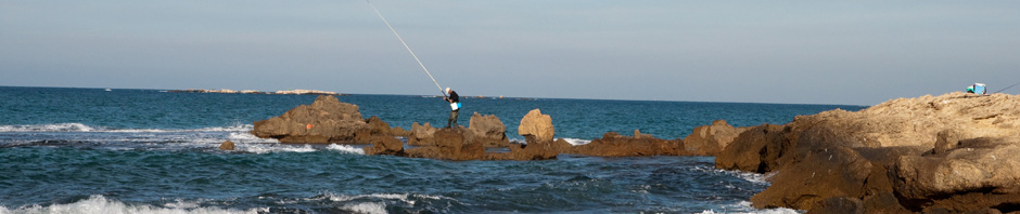
First case study site chosen for detailed analysis: Rosh HaNikra Marine Reserve


 The first part of this reserve was approved for protection in 1965 consisted of 311 dunams of mostly terrestrial area along the shore. An extension approved in 2009, added over 2,000 dunam and provides protection over a geographical area from the Rosh HaNikra grottos to the limits of the territorial waters (see chronological establishment of protection in the table below).
The reserve includes a long stretch of beach about 6.5 km, between Rosh National Park in the north to the remains of Achziv port in the south. The marine part consists of a number of small bays with partially submerged abrasion tables (and tidal pools). It encompasses a reef system at about 1.5 km offshore and six offshore islands in two clusters.
There are the isles of Rosh Hanikra: Techelet (“Light Blue”), Shachaf (“Seagull”), Nachlieli (“Wagtail”) and farther south the cluster of Achziv isles: Sgavion (named for the head of the synagogue at Achziv at the time of the Mishnah), Achziv Isle and the Achziv Reef isle. The islands are a focal point for nesting birds particularly for the Nachlieli. The isles have been classified as a nature reserve. The Isles, a single geological unit, make up tops of the western calcareous (Kurkur) mountain range of the Galilee coastal plain. They were formed as a result of the destruction of the calcareous ridge and the resulting eastward retreat of the coast.
There are a multitude of caves and tunnels in the natural rock structures along the shore, including a tunnel about 10 m, with a number of openings that create natural water fountains.These caves and holes are home to a variety of organizms, including octopus, sponges, crabs and various fish. In the reserve are a number of dive sites.
|
DATE ESTABLISHED |
SIZE (1000 m2) |
NAME |
|
10.6.65 |
311 |
ROSH HANIKRA ISLES RESERVE |
|
18.12.69 |
500 |
ROSH HANIKRA NATURE RESERVE |
|
15.6.72 |
220 |
ROSH HANIKRA NATIONAL PARK |
|
5.9.96 |
765 |
ROSH HANIKRA NATURE RESERVE EXPANSION |
|
16.1.2003 |
230 |
ROSH HANIKRA BEACH NATURE RESERVE |
|
9.2.2010 |
2784 |
ROSH HANIKRA CLIFF RANGE NATURE RESERVE |
Posted in Uncategorized
Comments Off on First case study site chosen for detailed analysis: Rosh HaNikra Marine Reserve
First Periodic Report Submitted to the EU
This two page summary outlining the accomplishments of the first 16 months of the project. Overall research objectives and next steps are also mentioned.
Posted in Uncategorized
Comments Off on First Periodic Report Submitted to the EU
Project Update
Winter 2012: Project transferred from Hebrew University of Jerusalem to Technion – Israel Institute of Technology
Posted in Uncategorized
Comments Off on Project Update
New Publication on Marine Spatial Planning
This articles describes research that uses quandrant analysis to evaluate the level of integration achieved by marine spatial planning. It explores specific countries’ recent marine spatial plans as case studies. Conservation goals designed to protect the marine environment within these plans are also addressed.
Posted in Uncategorized
Comments Off on New Publication on Marine Spatial Planning
June 2011: Annual Conference of the Israel Society of Ecology and Environmental Sciences, Megiddo, Israel
From the Shores of Israel to Gibraltar: Current Status of Marine Protected Areas of the Mediterranean Sea
Click here for PDF of Presentation (in Hebrew)
Posted in Uncategorized
Comments Off on June 2011: Annual Conference of the Israel Society of Ecology and Environmental Sciences, Megiddo, Israel